Friends,
We visited the Lincoln Library Sangamon Valley Collection recently to investigate the history of the railyard property next door to the Pillsbury site. We found that it was initially developed right round 1900 as a 40-acre railyard. In 1929, Pillsbury purchased the southwest half of the railyard for their flour milling and manufacturing operations.
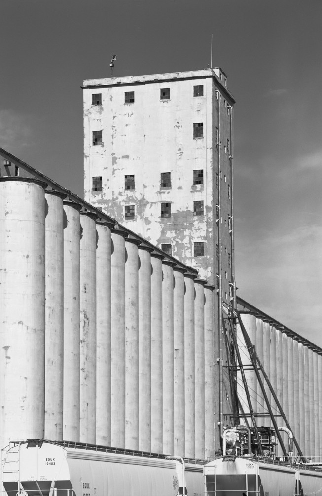
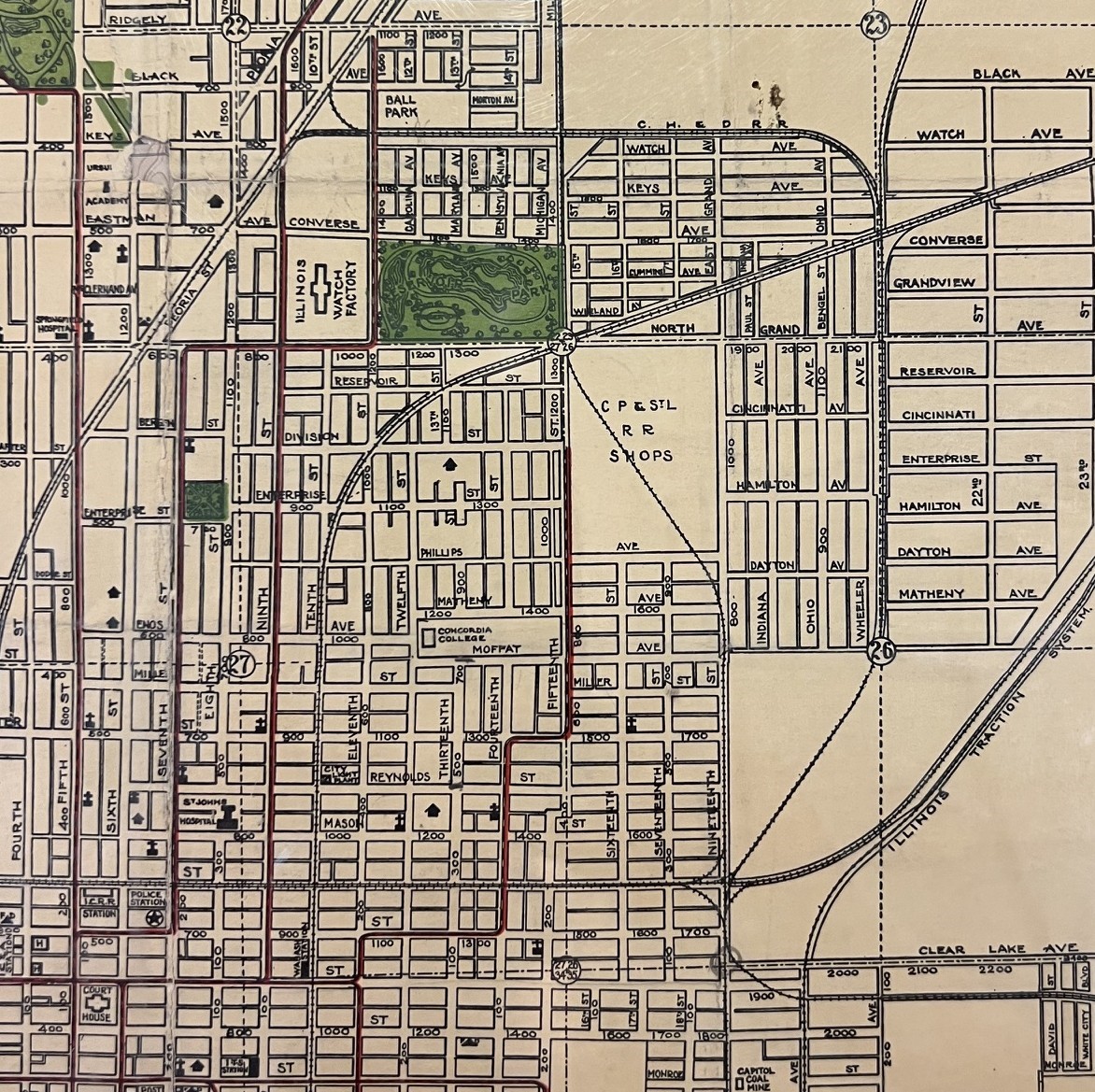
The attached 1907 map of the site shows that the railyard had already been developed with several sets of tracks and a roundhouse. Pillsbury bought the four rail sightings on the southwestern side of the property in 1929 and utilized them to bring in materials to build their five initial buildings. These buildings included: the Headhouse, the AB-Mill, Warehouse #1, Warehouse #4, and Grocery Building. Also included were the 52 south silos with a grain capacity of 1,00,000 bushels. These buildings totaled over 250,000 square feet of manufacturing and warehousing space.
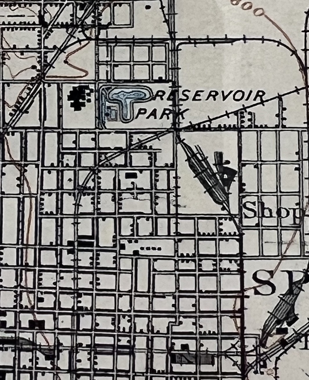
The 1922 map of the area is also quite revealing. Although it has less detail regarding the railyard, it shows the trolley line (red) that ran along North 15th Street right in front of the future Pillsbury site. Clearly, the area was prime for development when Pillsbury purchased the site in 1929. The property was ready for buildout and accessible to workers throughout the city via the trolley line. Also of note on this map is Reservoir Park, Illinois Watch Factory, and Concordia College.
Four of the original five buildings at the site have been demolished these past several months. The Headhouse, standing 224 feet tall, is the last. We anticipate that it will be torn down in the next few months. Currently, the Headhouse is the third tallest building in Springfield. Only the State Capitol and Wyndham Hotel are taller.
Thanks for being a part of this important community project!
~ Team Pillsbury